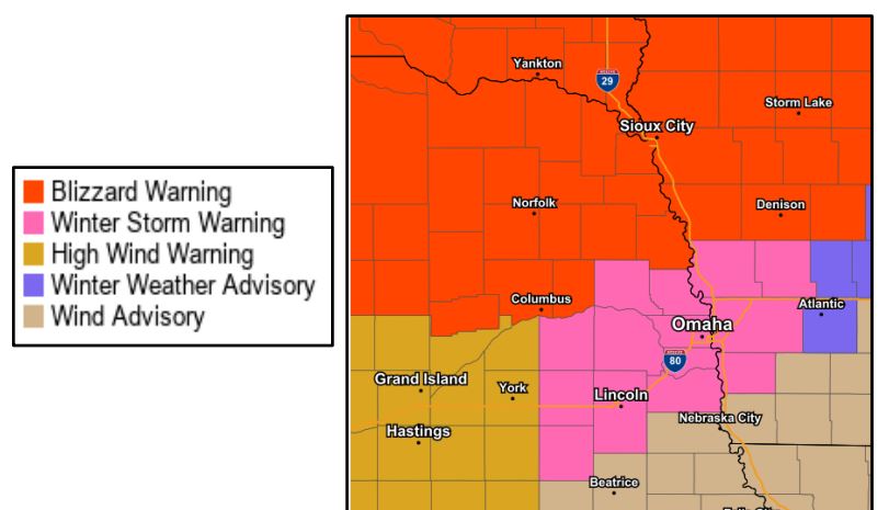

FREMONT – The National Weather Service has issued a Winter Storm Warning for portions of eastern Nebraska and western Iowa, including Dodge, Saunders, Washington and Douglas counties, through 9PM tonight.
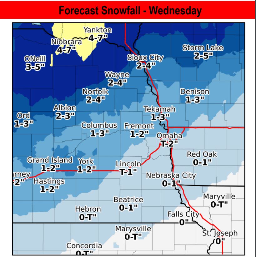
Some ice accumulation is possible before 10AM, when precipitation is expected to change over to snow. Snow totals are expected to be low, in the 1-2 inch range, but the snow is expected to be wet and heavy. Higher snow totals up to six inches and blizzard conditions are expected to the north of Dodge county.
Additionally, gusting winds up to 60 mph today will cause blowing snow and could result in whiteout conditions at times. Winds will be the primary risk factor today, with gusting winds creating dangerous cross winds on open roads, including highways. High winds could also result in tree and power line damage. These issues may cause isolated power outages.
Roads will be slick, and travel will be impacted. Snowfall will peak between 12PM and 3PM, with hazardous winds expected to continue into the late evening.