

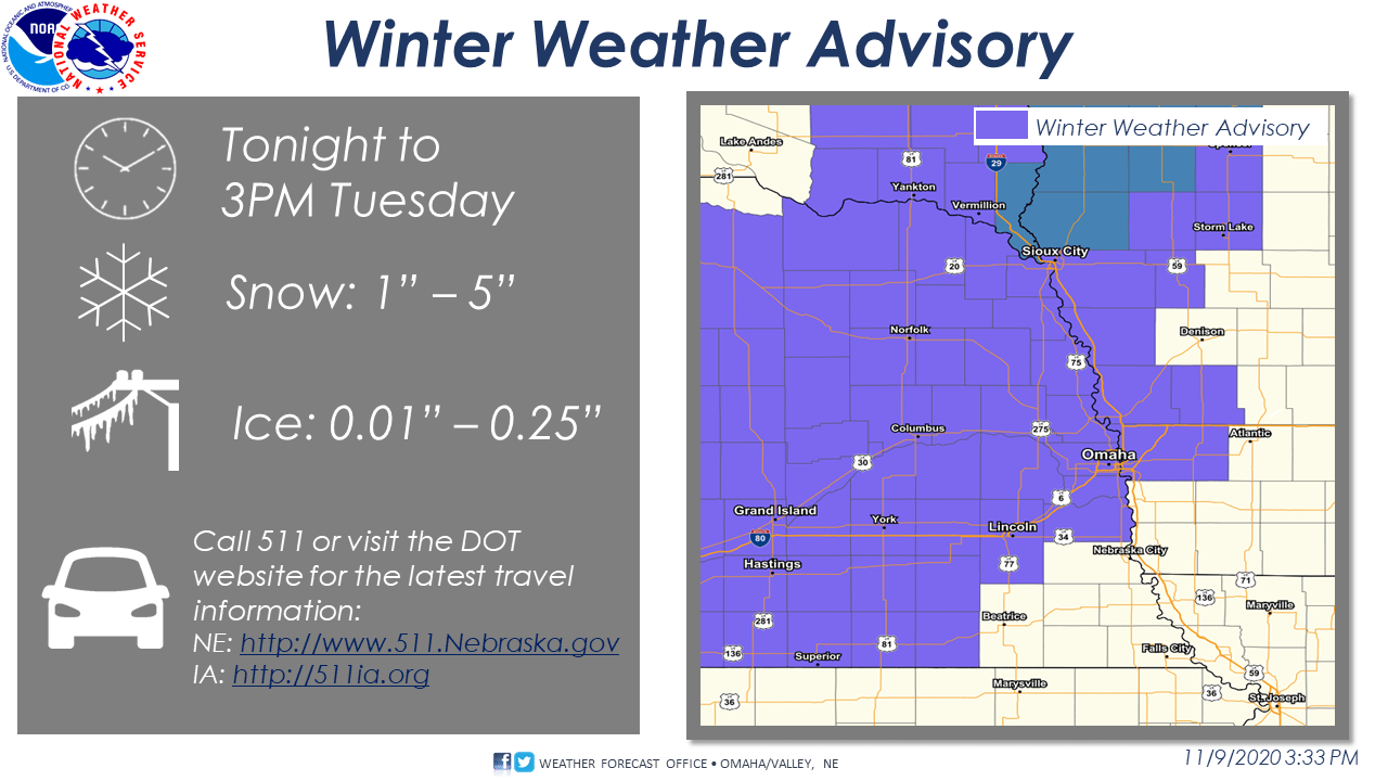
VALLEY – Despite last week’s above normal, and sometimes record-setting, temperatures – it looks like wintry weather is here again. The National Weather Service has issued a Winter Weather Advisory, in effect from Midnight to 3PM on Tuesday.
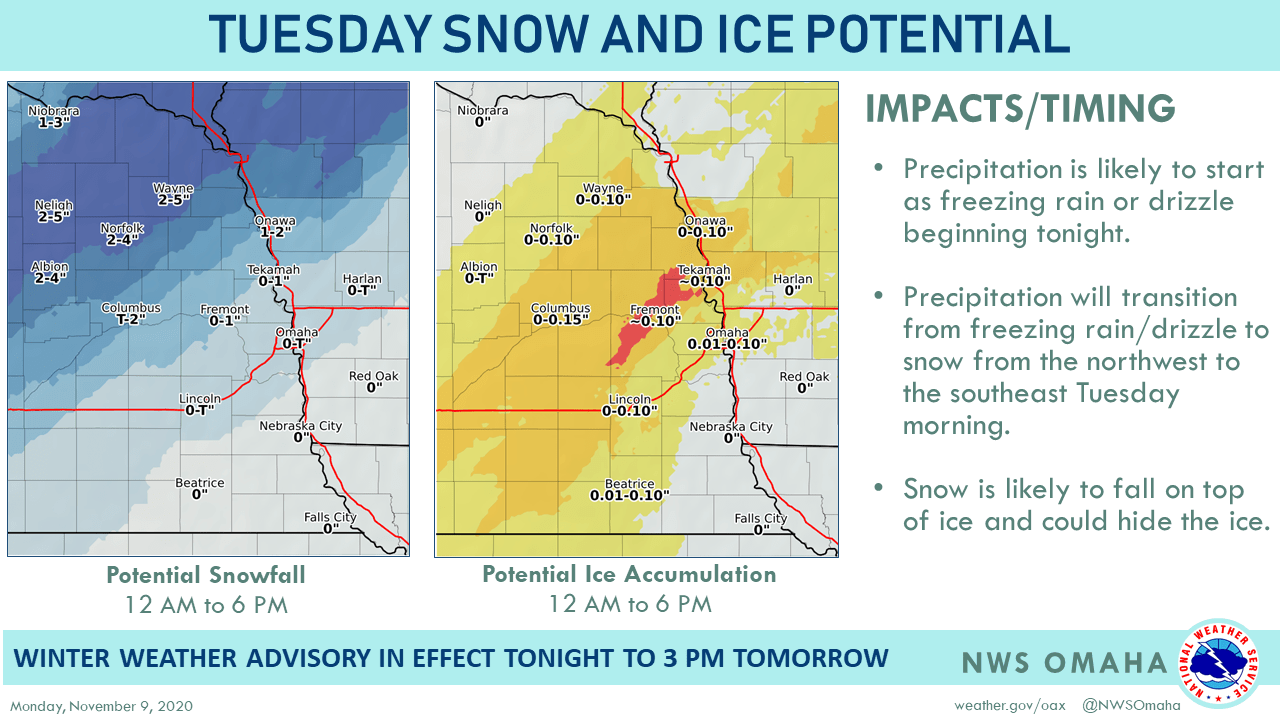
Most of eastern Nebraska and western Iowa can expect a wintry mix of rain, ice and snow to begin late this evening and intensify overnight, especially toward the morning commute Tuesday. The peak intensity will be in the morning hours between 4 am and 10 am. “There is high uncertainty in the precipitation types in the area from Norfolk to Onawa to Fremont to Columbus,” said the Weather Service. “Ice accumulation would have the largest impact if realized, as it could lead to slick roads, power outages, and tree damage.”
Icing will generally depend on the air temperature as precipitation begins – colder air will result in more snow and less ice. The higher snow totals, in the 4-5″ range, will likely stay to the northwest of Columbus.
Some ice accumulations over two-tenths of an inch are likely, generally northwest of the Omaha Metro area, including in Fremont. Some icing is also likely along I-80 from Lincoln to Omaha and Council Bluffs where up to a tenth of an inch of ice accumulation is possible.
Commuters should be prepared for a slower Tuesday commute. Check 5-1-1 for road conditions before you head out for the latest information on icy roads, download the NE 511 app or visit www.511.nebraska.gov.